Skip to main content
Home
Historical Maps
World History
U.S. History
Canadian History
Canada (English)
Canada (Français)
Old School History Maps
Stories on the Map
Armenia
Assyria
Catalonia
Kurdistan
Palestine
Ukraine
Edmaps +
Historical Maps of Mexico
Map Collections and Atlases
Atlas histórico de México
Atlas mexicano
(Antonio Garcia Cubas, 1884)
Atlas pintoresco é histórico de los Estados Unidos Mexicanos
(Antonio Garcia Cubas, 1885)
Blank and Outline Maps of Mexico
(d-maps.com)
Historia del mapa de México
(Gonzalo Prieto - geografiainfinita.com)
Historical Maps of Mexico
(American Geographical Society Library Digital Map Collection)
Historical Maps of Mexico
(David Rumsey Map Collection)
México: 20 mapas que muestran como su territorio ha cambiado desde la Independencia
(Darinka Rodriguez)
México: Mapas históricos
(Gobierno de México - Mapoteca Manuel Orozco y Berra)
México: Mapas históricos
(Instituto Geográfico Nacional - España)
Mexico: Historical Maps Collection
(Library of Congress)
Mexico: Historical Maps Collection
(Yale University Library Digital Collections)
Mexico Maps
(Perry-Castañeda Library Map Collection)
Old Maps of Mexico
(oldmapsonline.org)
Outline Maps of Mexico
(Enchanted Learning)
Planos y Mapas históricos de México
(Biblioteca Digital Mexicana)
Maps
Noted Archeological Sites
(S. Arbingast et alii, Atlas of Mexico, 1975)
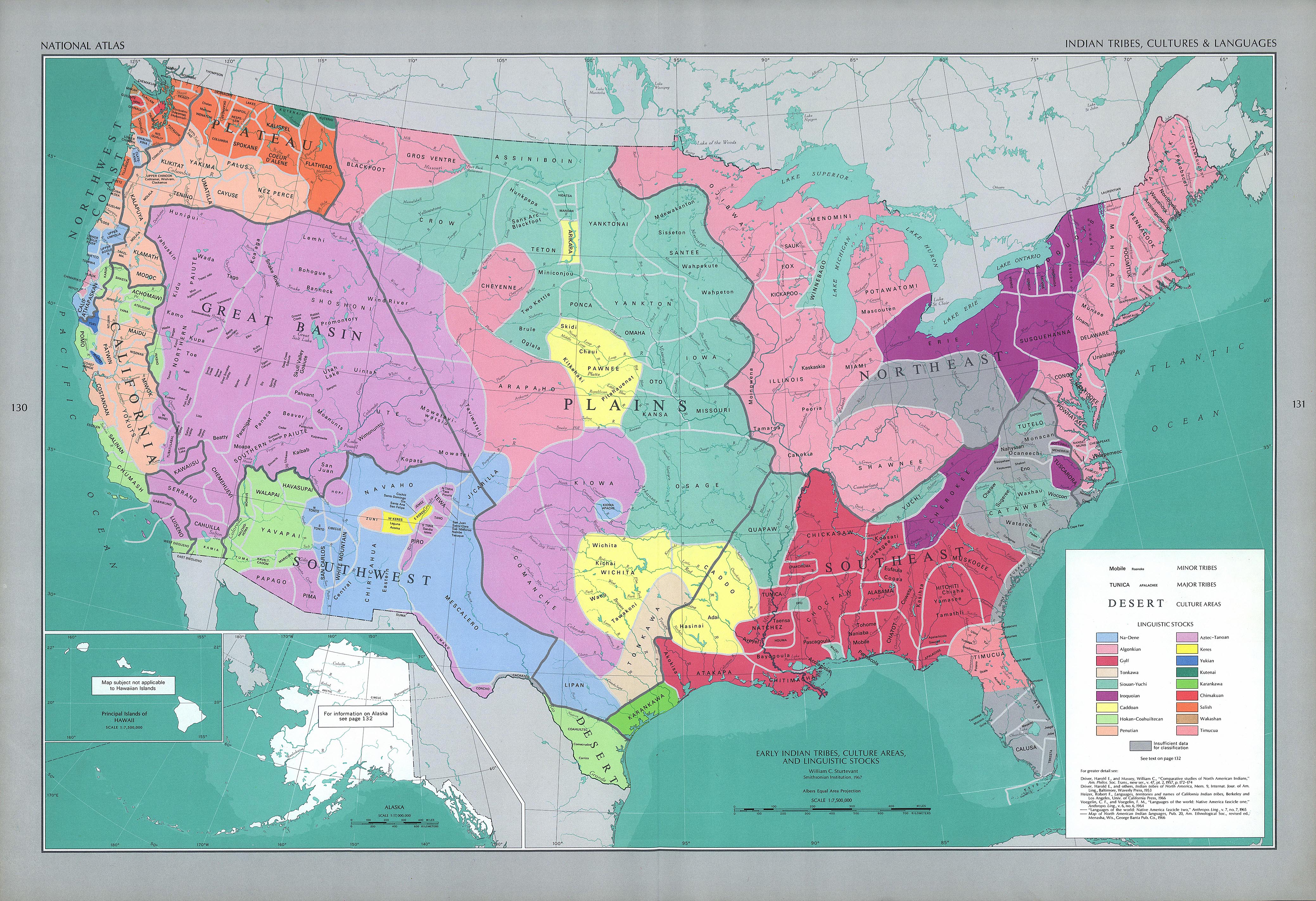
Indian Tribes, Culture and Languages
(The National Atlas of the United States of America, 1970)
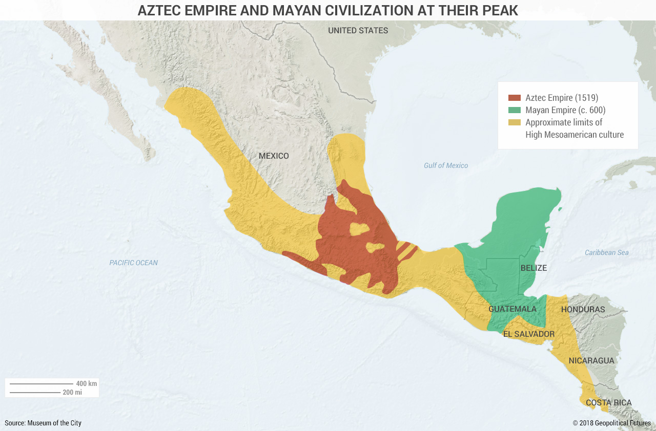
The Mesoamerican Civilisations
Aztec Empire and Mayan Civilization at Their Peak
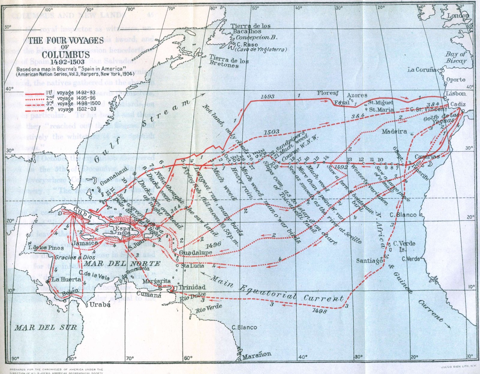
Discovery of North America
(The National Atlas of the United States of America, 1970)
The Four Voyages of Columbus, 1492-1503
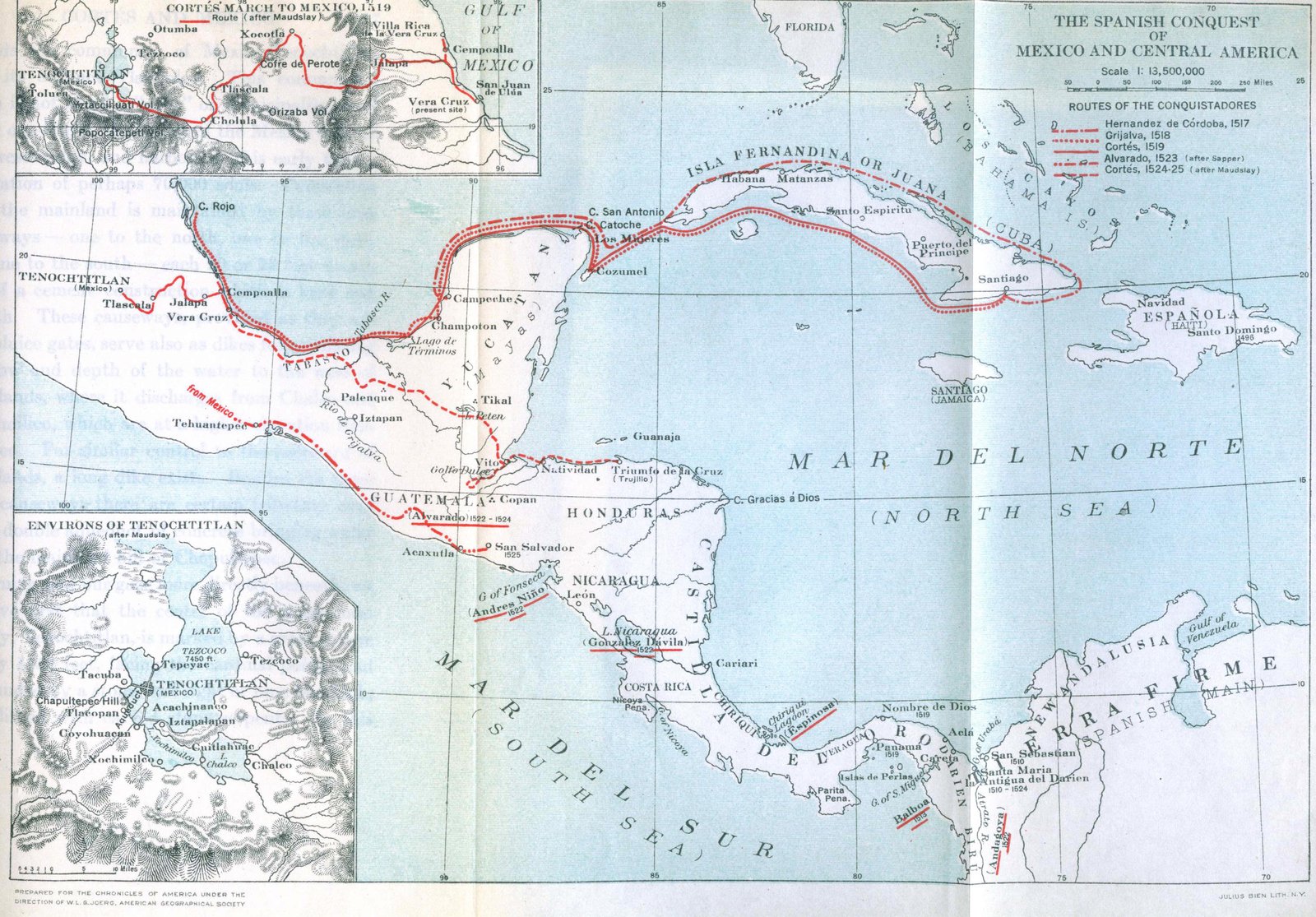
The Spanish Conquest of Mexico and Central America
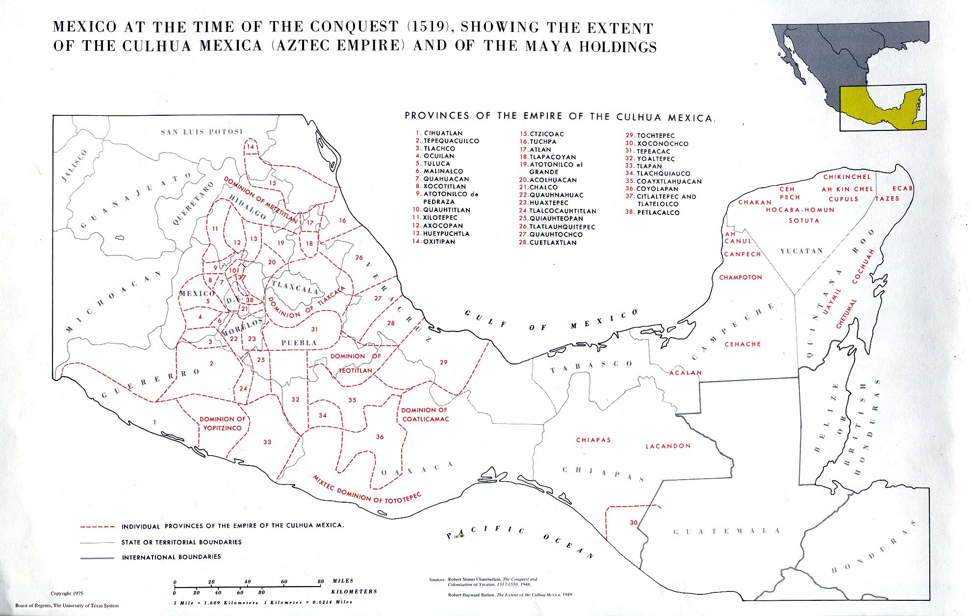
Mexico at the Time of Conquest, 1519
(S. Arbingast et alii, Atlas of Mexico, 1975)
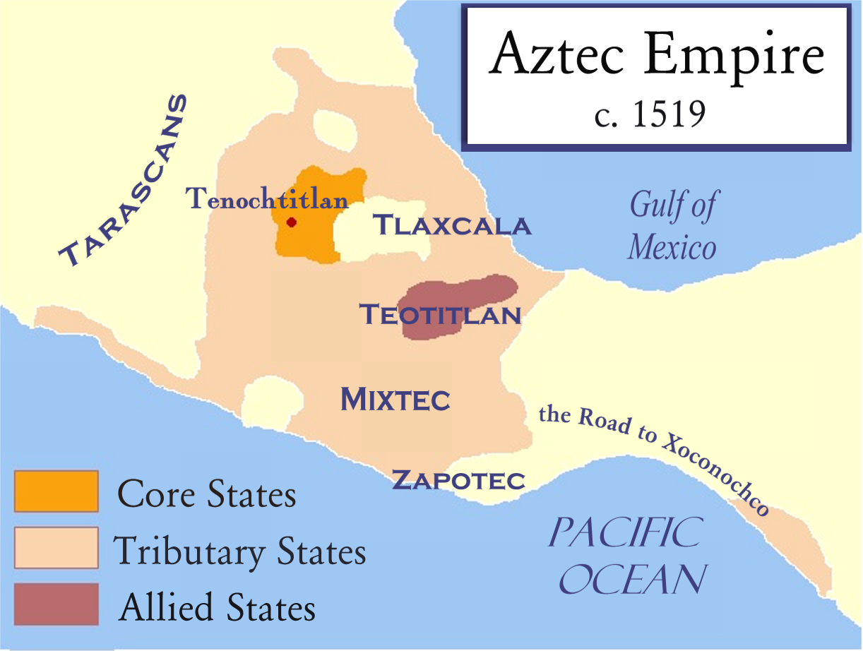
The Aztec Empire, 1519
(Wikipedia)
North America
(Droysens Allgemeiner Historischer Handatlas, 1886)
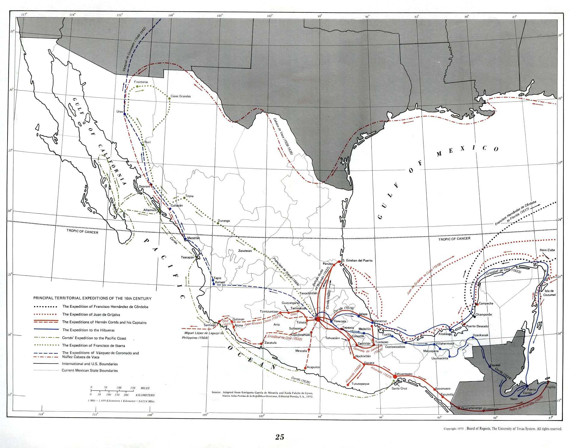
Principal Territorial Expeditions of the 16th Century
(S. Arbingast et alii, Atlas of Mexico, 1975)
Viceroyalty of New Spain, ca 1650
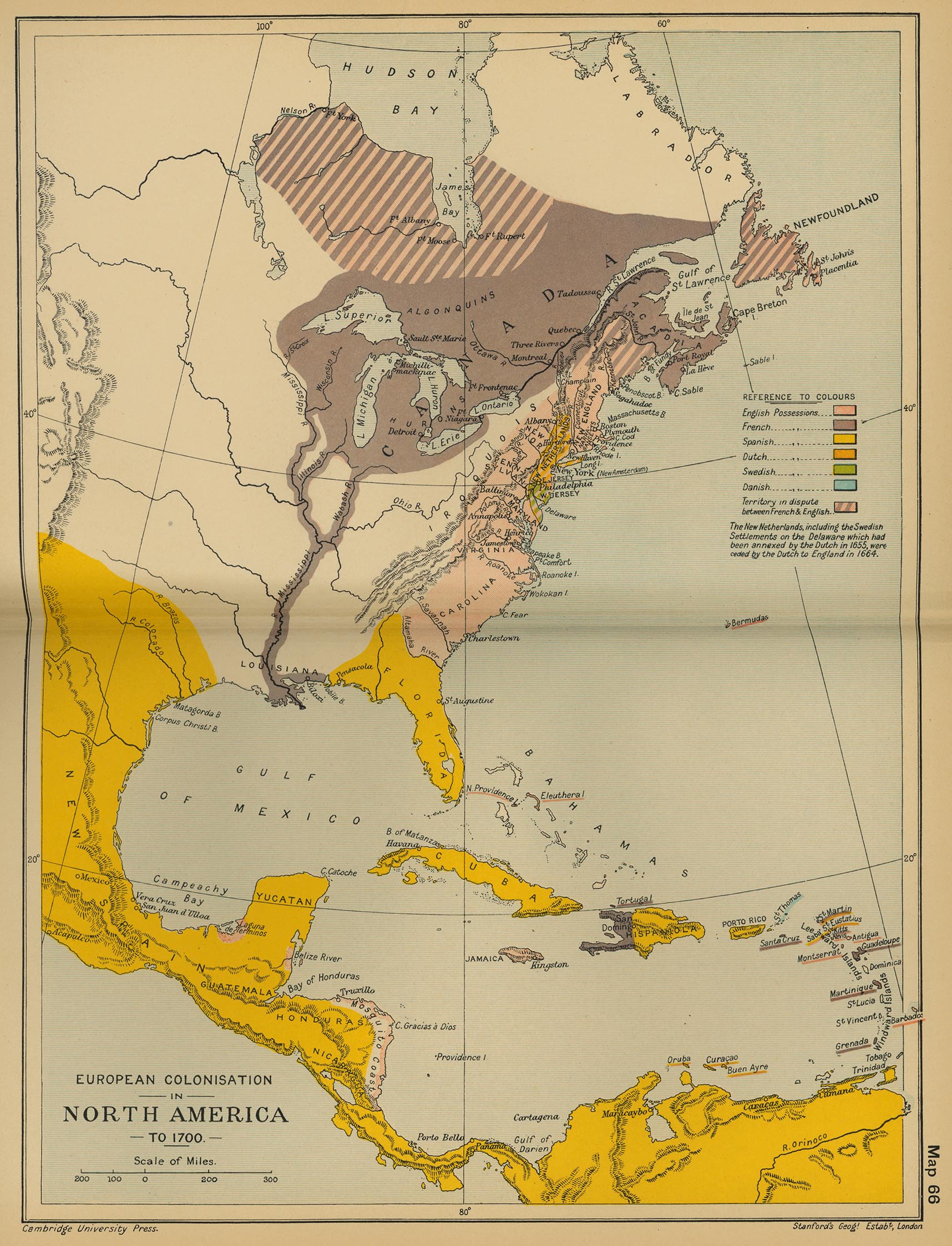
European Colonisation in North America, c. 1700
(Cambridge Modern History Atlas, 1912)
Mexico: Epoca Colonial
Spanish and Portuguese America, 1780
(Encyclopaedia Britannica)
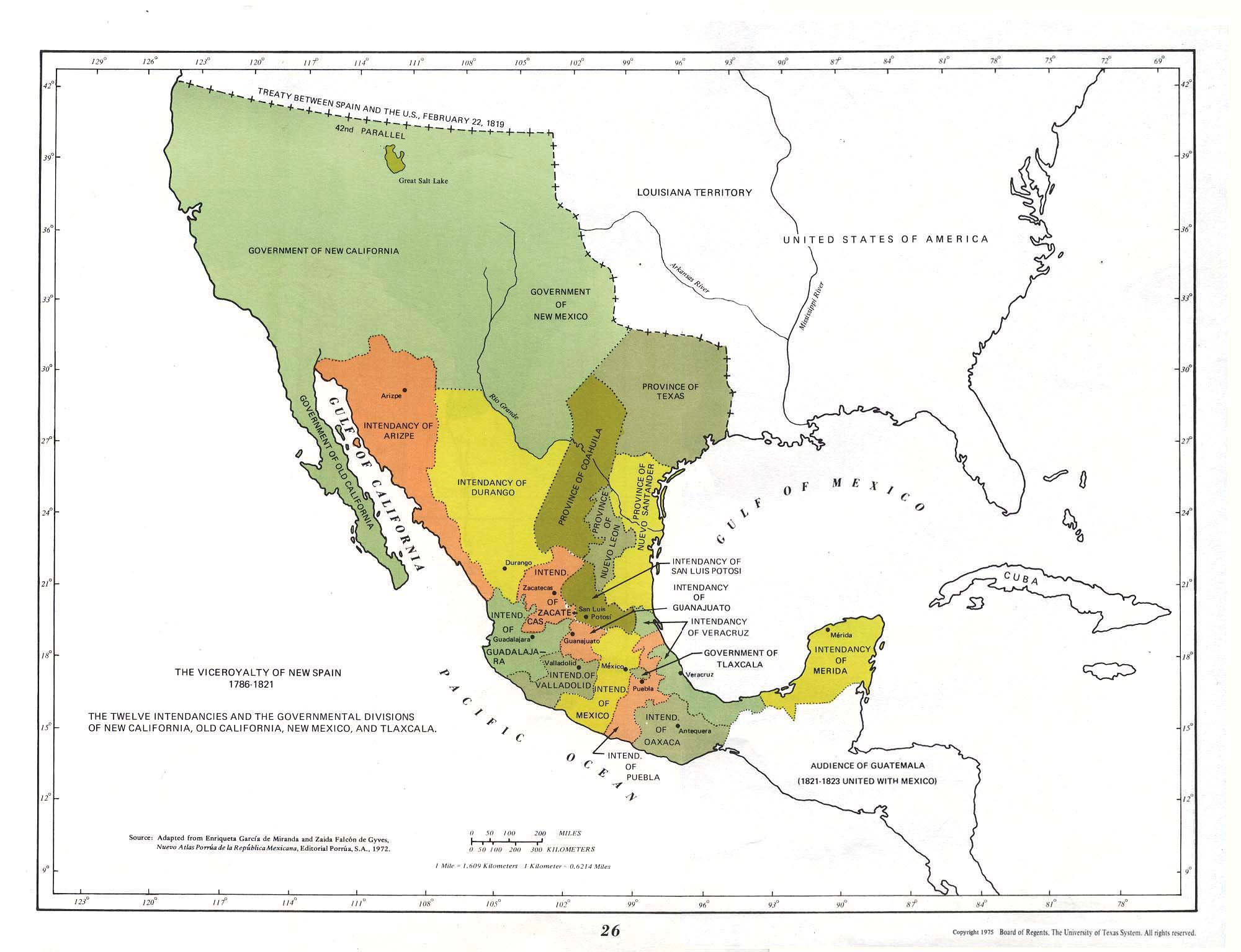
The Viceroyalty of New Spain, 1786-1821
(S. Arbingast et alii, Atlas of Mexico, 1975)
Viceroyalty of New Spain, 1796-1821
Viceroyalty of New Spain, ca 1800
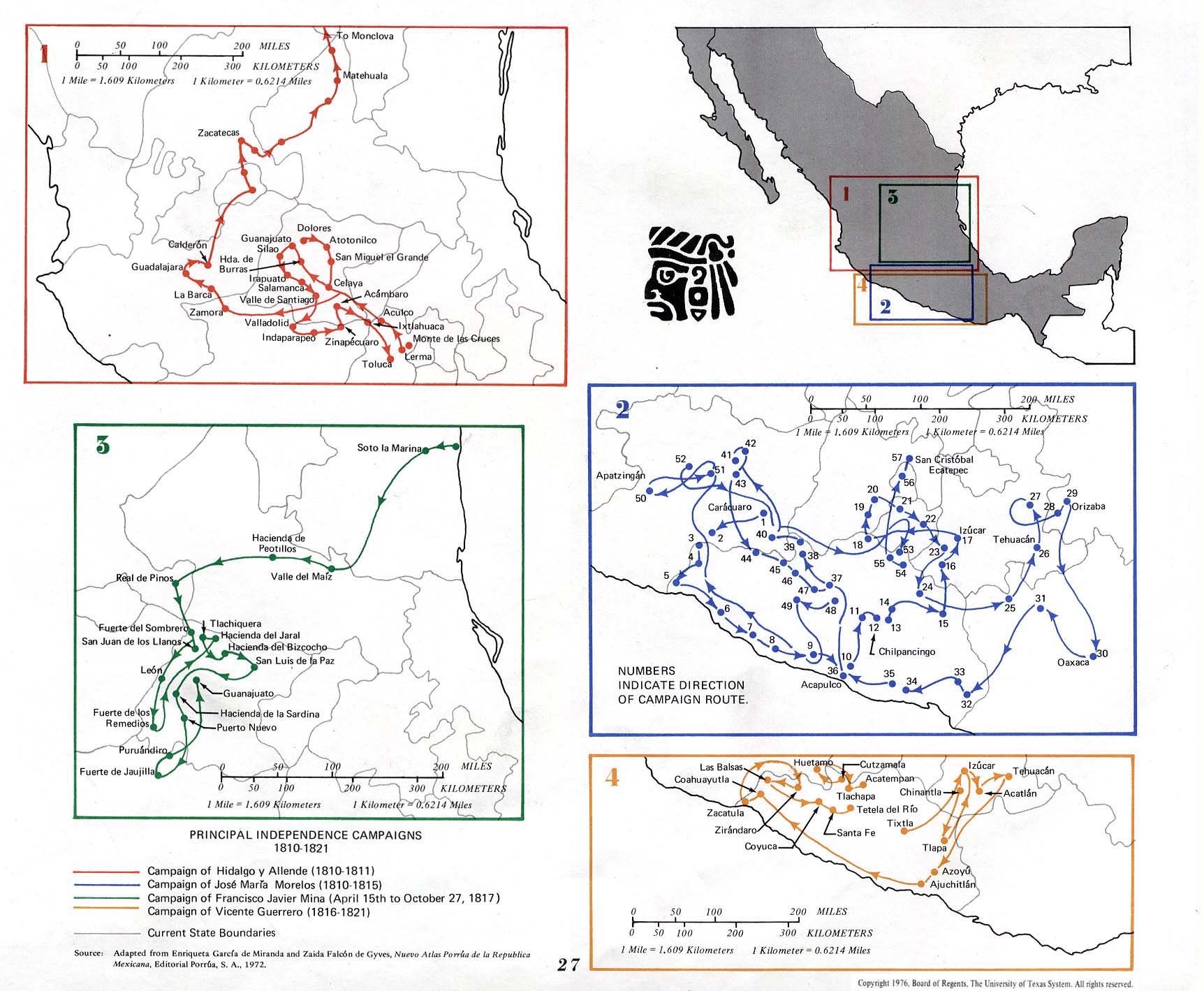
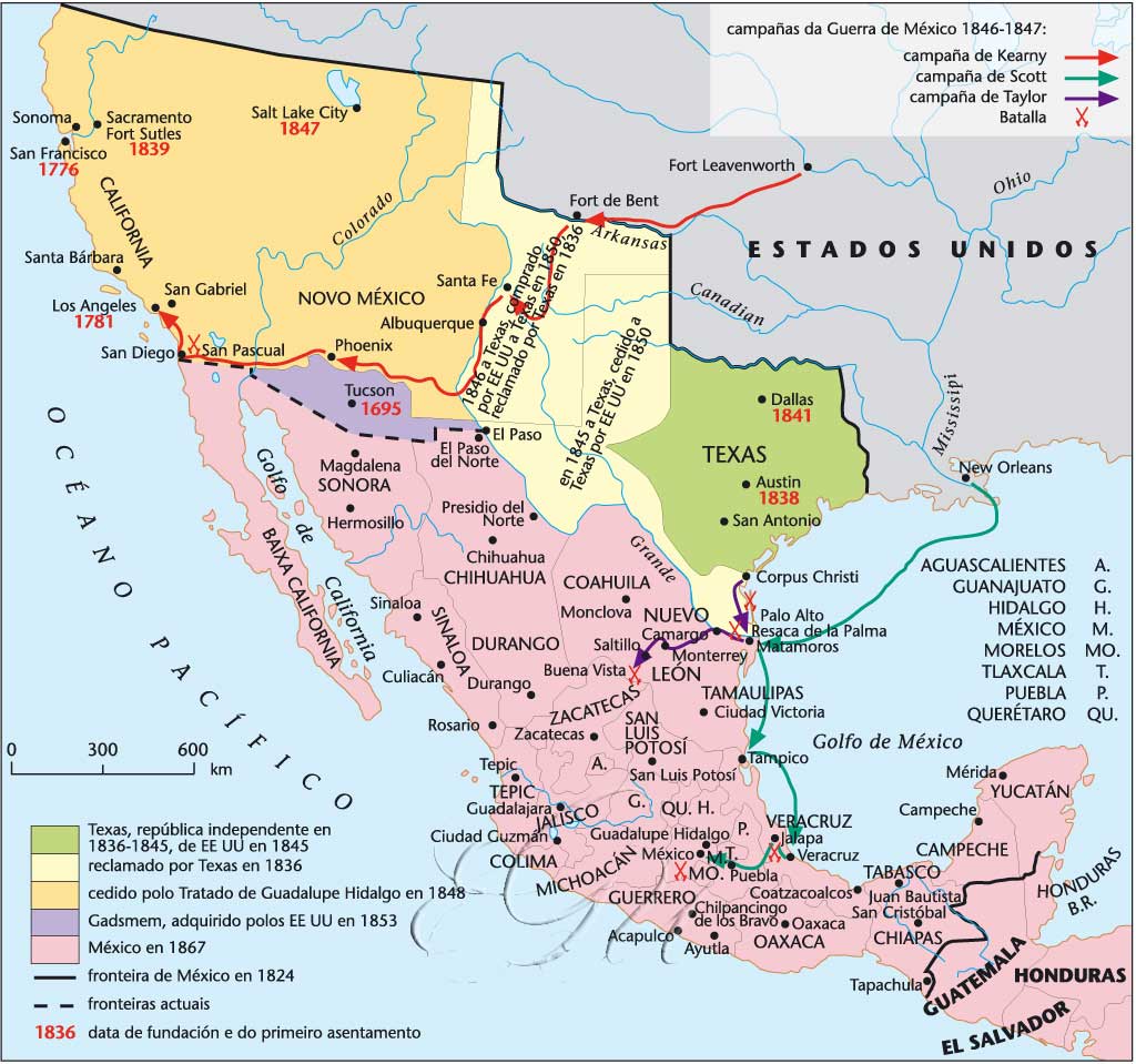
Principal Independence Campaigns 1810-1821
(S. Arbingast et alii, Atlas of Mexico, 1975)
The Viceroyalty of New Spain in 1819
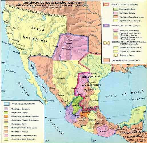
Las Intendencias del Virreinato de la Nueva Espana, 1820
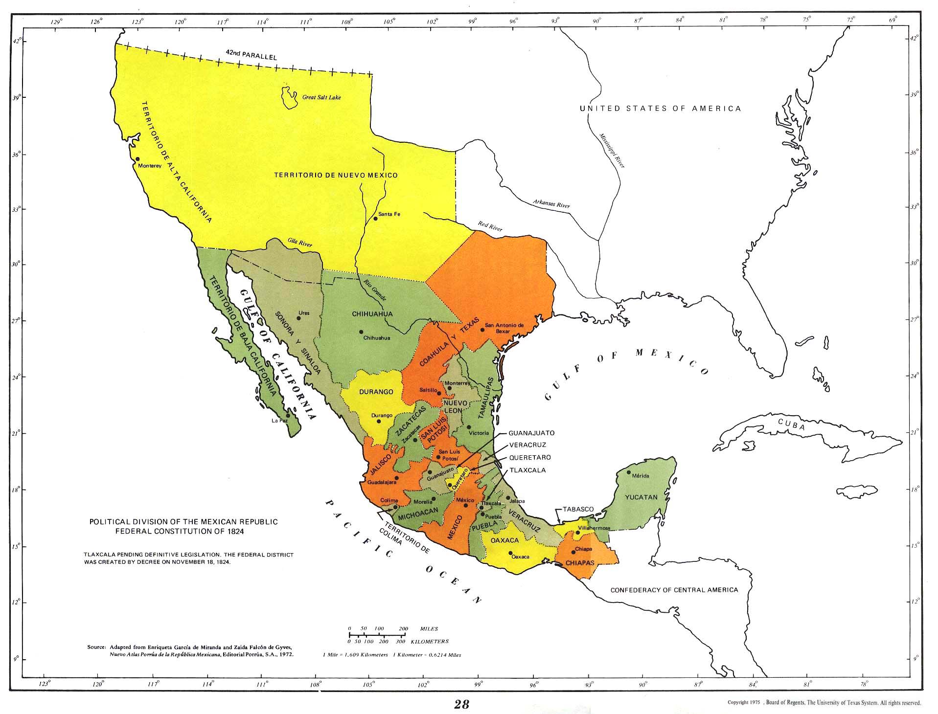
The Mexican Republic in 1824
Political Divisions of the Mexican Republic Federal Constitiution of 1824
(S. Arbingast et alii, Atlas of Mexico, 1975)
Mexico, 1824-1867
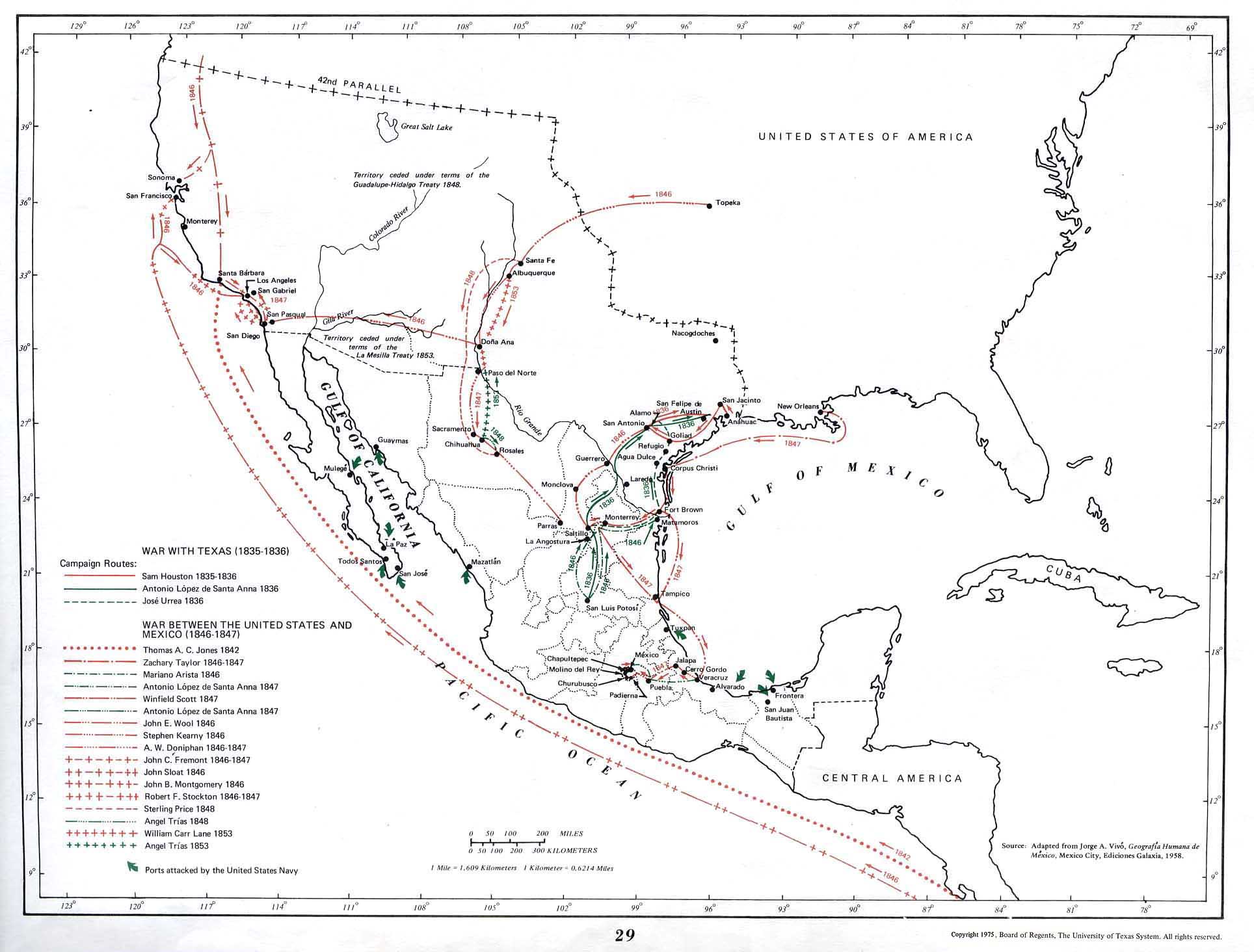
War with Texas (1835-1836)
(S. Arbingast et alii, Atlas of Mexico, 1975)
Territorial Division of Mexico, 1835-1846
(Wikipedia)
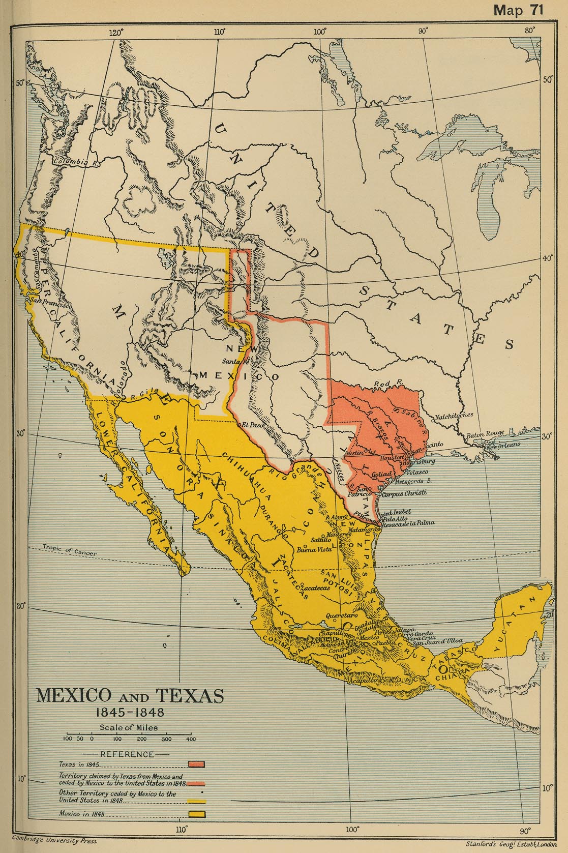
Mexico and Texas, 1845-1848
(Cambridge Modern History Atlas, 1912)
A Map of the United States of Mexico, 1846
(H. S. Tanner)
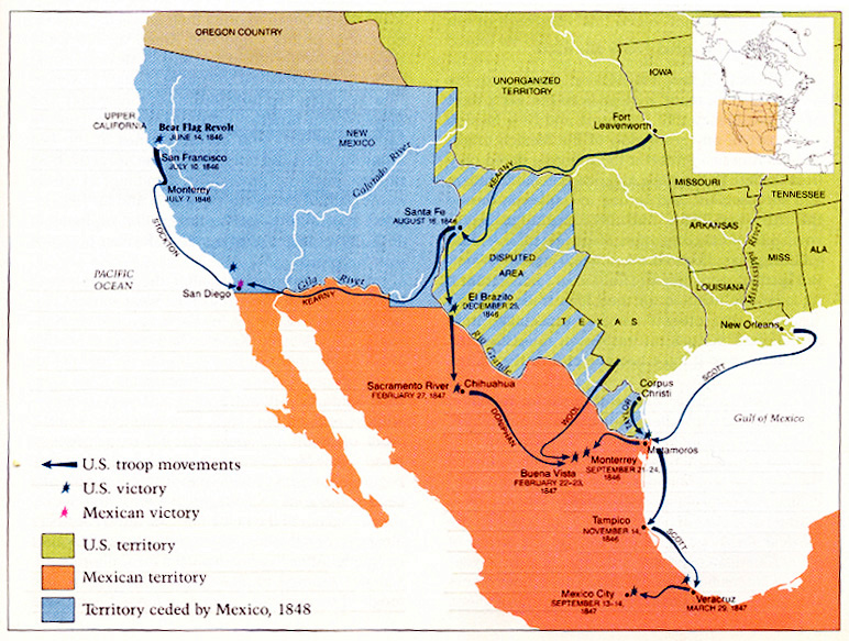
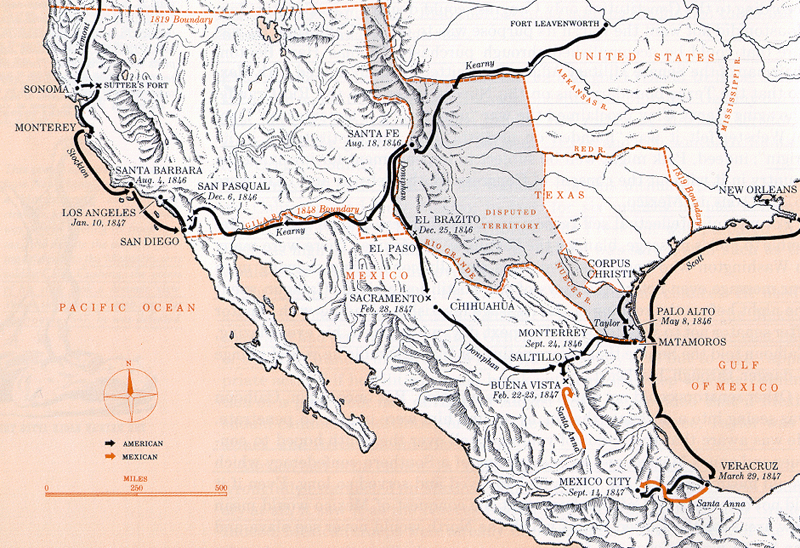
Mexican War (a)
Mexican War (b)
The War of French Intervention 1862-1867
(S. Arbingast et alii, Atlas of Mexico, 1975)
Carta general de la República Mexicana, 1863
Carta etnográfica de México
(Manuel Orozco y Berra, 1864)
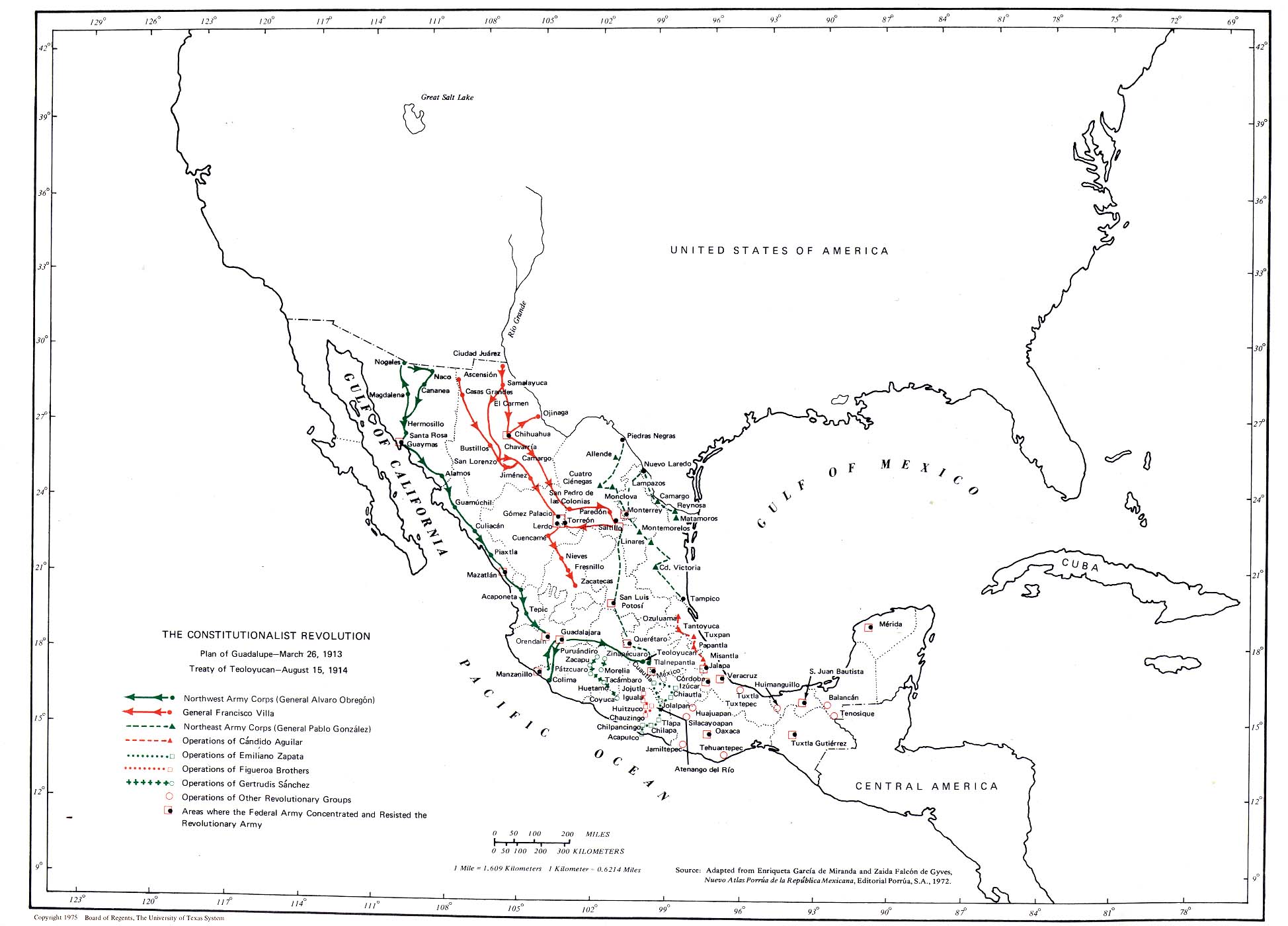
The Constitutionalist Revolution
(S. Arbingast et alii, Atlas of Mexico, 1975)
Mexico, 1911
(National Geographic)
Mexico and Central America, 1920
(J.G. Bartholomew)
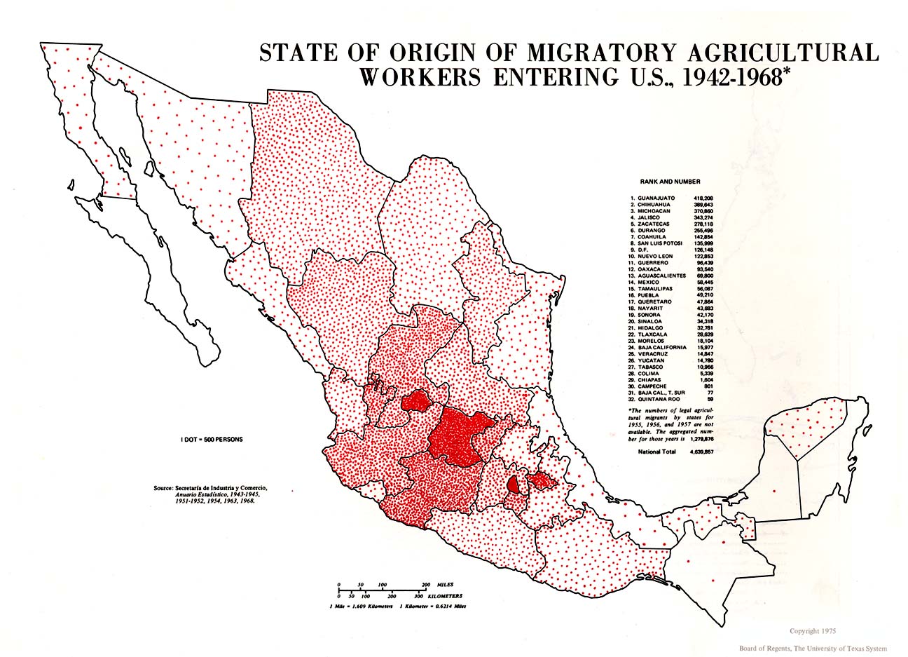
State of Origin of Migratory Agricultural Workers Entering U.S., 1942-1968
(S. Arbingast et alii, Atlas of Mexico, 1975)
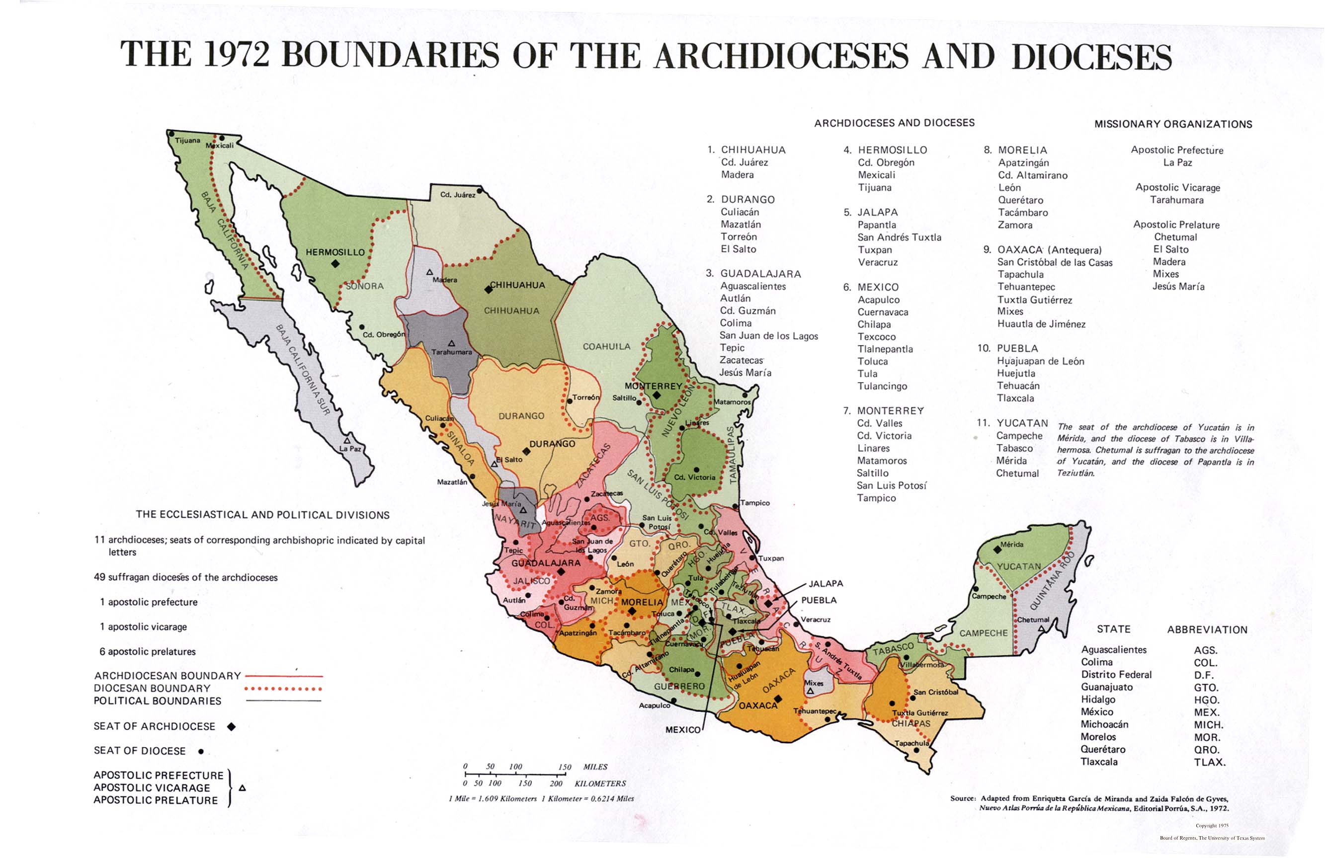
The 1972 Boundaries of Archdioceses and Dioceses
(S. Arbingast et alii, Atlas of Mexico, 1975)
Mexican States GDP per capita as countries (PPP), 2012
Latin America
Argentina
Brazil
Chile
Colombia
Asia
Europe
Middle East
Canada
U.S.A.


.png)